German Enamelled Sign, 1950s
¥70,575

You are now following Wall Decor. You can manage alerts in your account settings.
You have unfollowed Wall Decor.
German Enamelled Sign, 1950s
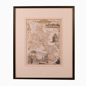
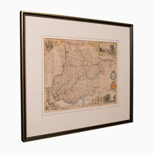
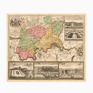
19th Century English Oxfordshire Country Map
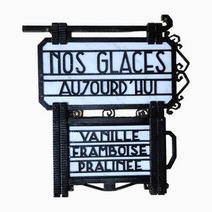
Art Deco Store Sign, 1930s
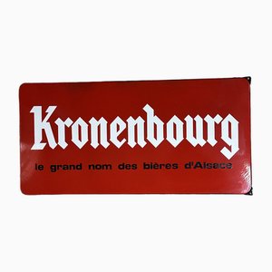
Vintage Enameled Kronembourg Advertising Plaque, 1960s
Bicycle Safety Campaign Sign, Japan, 1980s

Japanese Bicycle Brand Hidetakas Maruei Enamel Sign, Shōwa Period, 1940s

Japanese Bicycle Brand Hidetakas Maruei Enamel Sign, Shōwa Period, 1940s

Enamel Advertising Sign for Hi-Earth Insecticide, Shōwa Period, Japan, 1960s

Metal Advertising Board for Sprite, Japan, 1970s
Enamel Advertising Board for Yamasa Soy Sauce, Japan, 1970s

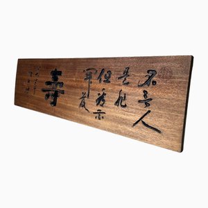
Japanese Wooden Shop Signboard, 1950s

Wooden Japanese Hanging Shop Signboard, 1960s
Antique English Victorian County Map
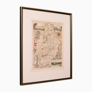
Antique English Framed Nottinghamshire Map
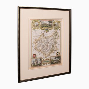
Antique English Framed Leicestershire Map
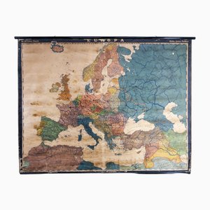
Large Early 20th Century School Wall Map Europe by Dr. Haack for Perthes, Gotha, 1890s
Las Vegas Led Light Sign, 1990s

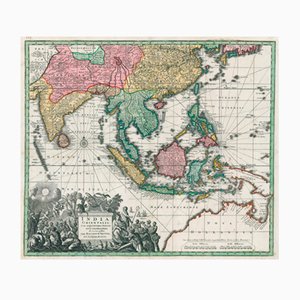
Matthäus Seutter, Antique Map India Orientalis (South East Asia), 1730, Engraving
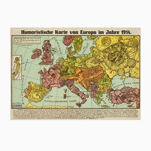
Antique Serio-Comic Map of Europe on the Brink of World War I by Lehmann-Dumont, 1914
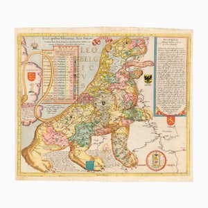
Antique Ecce, Quibus Hispaniar. Rex Philipp. Belgium (The First Leo Belgicus) Map by Michael Eytzinger, 1587
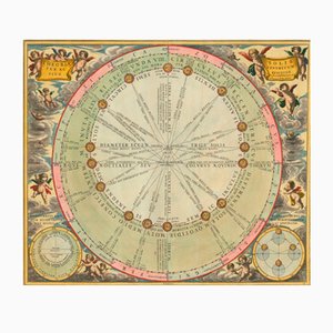
Antique Chart of the Motions of the Sun Through the Skies by Andreas Cellarius for Schenk & Valk, 1708
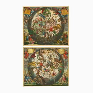
Antique Celestial Hemispheres Charts by Andreas Cellarius for Schenk & Valk, 1708, Set of 2
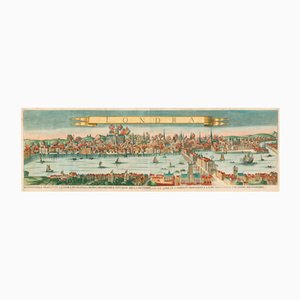
Antique Map of London by Gabriel Gualdo Priorato, 1675
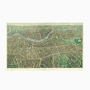
Antique Balloon View of London Map As Seen from Hampstead by John Henry Banks for Banks & Co. & Effingham Wilson, 1851
Map of the Environs of London with Inset Views of Royal Palaces by Johann Baptist Homann, 1710
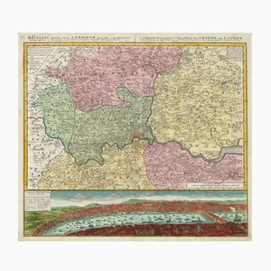
Antique Environs of London Map by Homann Heirs, 1741
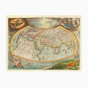
Antique Map of the Ptolemaic World by Gerard Mercator, 1700
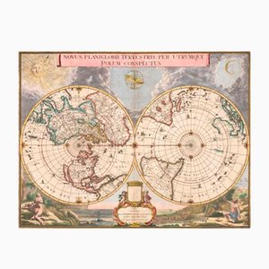
Antique Double Hemisphere Map of the World on a Polar Projection by J. Blaeu, 1695
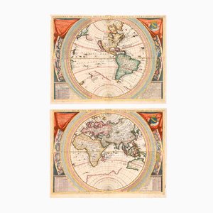
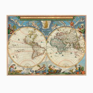
Antique 17th Century World Maps in the style of Coronelli, Set of 2
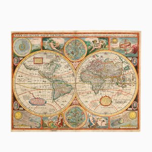
Antique Map of the World after J. Speed, 1651
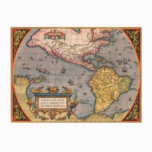
Antique America Sive Novi Orbis Nova Descriptio Map by Abraham Ortelius, 1598
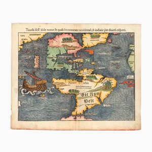
Antique First Map of the Continent of America by Sebastian Munster, 1558
Antique Nova et Accuratissima Totius Terrarum Orbis Tabula Map by Johannes Blaeu, 1662
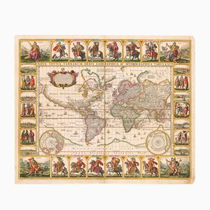
Antique Nova Totius Terrarum Orbis Geographica ac Hydrographica Tabula Claes Map by Janszoon Visscher, 1652
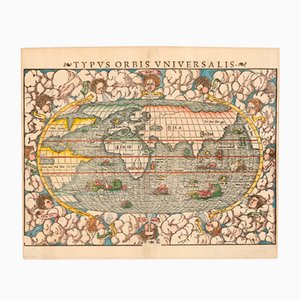
Typus Orbis Universalis Map by Sebastian Munster, 1552
Trending